8 of the best multi-day circular walks in the UK
-
If you click a link with an * and buy from a company’s website, I may receive a small payment. This helps fund the Outdoor Girl site and keeps it free to use with no annoying pop up adverts.
But there are a couple of crucial things you need to know about this:
It never impacts my content or recommendations – if I include something, I genuinely think will be helpful
There is no extra cost to you when buying via one of these links
For a more detailed explanation, see my policy on affiliate links, including Amazon Associate links.
For transparency, you can also find duplicate links below that don’t help fund the Outdoor Girl website.
GM Ringway
One of the most popular posts on this site is my guide to the best multi-day walks in the UK. But many of those are linear routes, which can be a logistical challenge when it comes to getting back to where you started.
So, this time, I’ve looked into some of the best circular long-distance walks across the UK. I’ve started in Scotland and headed south, picking out eight great routes that take more than a day to complete (unless you fancy running them in one go).
If you’re ready to find a new walking adventure, keep reading…
1. The Arran Coastal Way, Scotland
Length: 65 miles / 105 km
Ascent: 390 metres
Location: North Ayrshire, Scotland
Start / Finish: Brodick
Often called ‘Scotland in miniature’ the Isle of Arran squeezes in a bit of everything. Mountains, rolling hills, sandy beaches, and a varied mix of wildlife. You might spot seals, otters, golden eagles, or even basking sharks as you walk around the island.
The coastal loop goes right around the island. It starts and ends in Brodick, where the ferry from the mainland arrives. Most walkers go anticlockwise to make the most of teh sea views.
While the route mostly sticks to low-level paths, don’t be fooled. Some sections are rocky and remote, and the terrain can be tough going in parts.
Learn more: Arran Coastal Way official site
Guidebook: The Arran Coastal Way >> Find it on Amazon *

Map from: Scotland’s Great Trails
2. The Borders Abbeys Way
Length: 68 miles / 109 km
Ascent: 1,300 metres
Location: Scottish Borders, Scotland
Start / Finish: Tweedbank railway station (near Melrose)
This circular route winds through the rolling landscape of the Scottish Borders, linking historic towns and villages. It also passes four ruined abbeys - Melrose, Dryburgh, Kelso, and Jedburgh.
The path follows riverside trails, old railway lines, drovers’ routes, and quiet lanes. It includes long stretches beside the Rivers Tweed and Teviot, along with rugged hilly sections where you can see views towards the Cheviots.
Most people walk the route clockwise for the best views. Despite a few tarmac sections, and one exposed stretch over Black Hill (where good navigation skills are needed in poor visibility), it’s waymarked and aimed at walkers with a moderate level of fitness.
Learn more: Borders Abbeys Way - Scotland’s Great Trails
Guidebook: Cicerone - Walking the Borders Abbeys Way >> Find it on Amazon *

3. The Herriot Way
Length: 52 miles / 84 km
Ascent: 2,350 metres
Location: North Yorkshire, England
Start / Finish: Aysgarth
This beautiful circular route explores some of the best scenery in the Yorkshire Dales. It visits valleys, moorlands, and villages made famous by James Herriot, the much loved vet from All Creatures Great and Small stories.
The walk is named after the fictional character but his real-life counterpart was Alf Wright. It follows a walking holiday he once did with his son around Aysgarth, Grinton, and Keld, passing through classic Dales landscapes.
Most walkers follow the route clockwise over four days with overnight stops in Hawes, Keld, and Reeth. It makes each day a similar distance with varied but manageable terrain. Top tip: take a look at the Dales Bike Centre near Reeth for an overnight stay.
Learn more: The Herriot Way official website
Guidebook: Walking the Herriot Way >> Find it on Amazon *

Map from: The Herriot Way official website
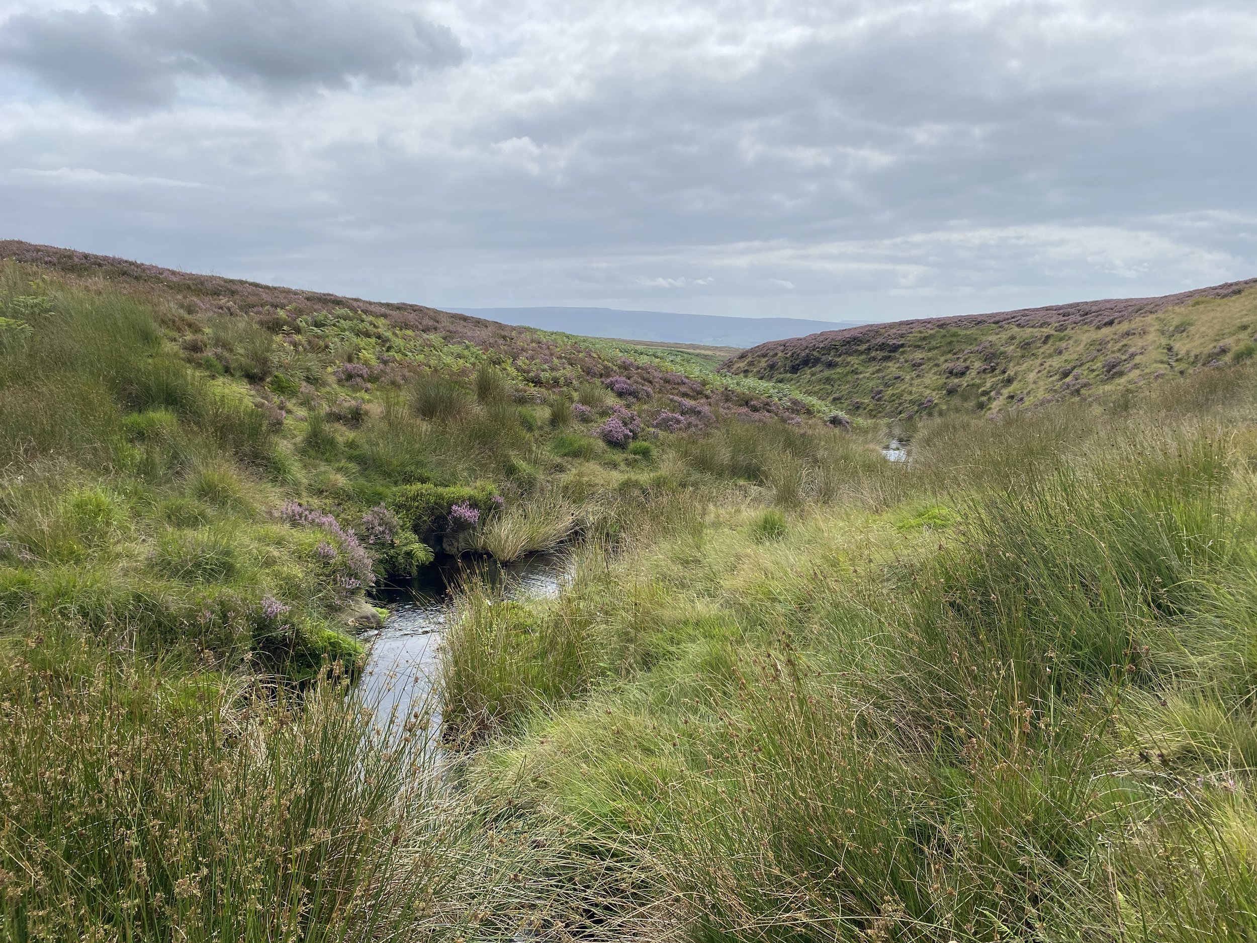
4 . The GM Ringway
Length: 200 miles / 322 km
Ascent: 2,469 metres
Location: Greater Manchester, England
Start / Finish: Manchester city centre
The GM Ringway is Greater Manchester’s very own long-distance walking trail. This 200-mile circular route explores green spaces, countryside, waterways, and heritage across all ten boroughs of the region.
It’s split into 20 one-day stages and designed to be fully accessible by public transport. It runs anti-clockwise and is grouped into four sections:
The Southern Start-Up
The Exhilarating East
The Noble North
The Western Wind-Down
Using existing footpaths, parks, and canal towpaths, the trail connects local communities. But don’t think it’s all about built-up areas, the route goes on some of the most beautiful peat moorland in the country.
Learn more: GM Ringway official site

Map from: GM Ringway official site
5. The Inn Way…to the Peak District
Length: 84 miles / 135 km
Ascent: 4,213 metres
Location: Peak District, Derbyshire, England
Start / Finish: Hayfield
This six-day circular route through the Peak District combines stunning scenery with pubs (51 at the time of writing). It’s part of the popular Inn Way series of guidebooks, and this edition takes in everything from wild moorland to limestone dales.
Starting and finishing in Hayfield, the walk goes around the Peak District National Park. You’ll cross Kinder Scout, follow the Eastern Edges above the Derwent Valley, wander through Chatsworth Park, explore Stanton Moor’s stone circle, and enjoy the classic limestone dales of the White Peak.
Each day covers 11-17 miles and ends in a village with cosy pubs and overnight options. The route is well described in the official guidebook and uses OS Explorer maps OL1 (Dark Peak) and OL24 (White Peak).
Learn more: The Inn Way official site
Guidebook: The Inn Way…to the Peak District by Mark Read >> Find it on Amazon *

Map from: Brigantes Walking Holidays
6. The Snowdonia Slate Trail
Length: 83 miles / 133 km
Ascent: 4,451 metres
Location: Eryri (Snowdonia) National Park, Wales
Start / Finish: Bangor or Bethesda
This 83-mile circular walk goes through the dramatic mountains, valleys, and villages of Eryri (Snowdonia) National Park. Created in 2017, it links key sites in North Wales’s slate quarrying heritage - a UNESCO World Heritage landscape - with some of the most spectacular scenery in the country.
The route passes through a mix of rugged upland terrain, remote moorland, and quiet valley paths. It uses a combination of public footpaths, permissive tracks, and minor roads. You’ll walk beside disused quarry workings and over open hill country, so good navigation skills are useful in poor weather.
It typically takes 7 days to complete and is ideal for walkers looking for a quieter long-distance route. There are also QR codes along the trail giving insights into local history and geology.
Learn more: Snowdonia Slate Trail official site
Guidebook: Snowdonia Slate Trail by Aled Owen >> Find it on Amazon *

Map from: Snowdonia Slate Trail official site
7. The Chiltern Way
Length: 134-177 miles / 216-285 km (depending on extensions)
Ascent: Variable
Location: Chiltern Hills, England (covering parts of Bedfordshire, Buckinghamshire, Hertfordshire, and Oxfordshire)
Start / Finish: Hemel Hempstead (or join from several other points)
This long-distance circular walk goes through some of southern England’s most beautiful and unspoilt countryside. Winding through the Chilterns National Landscape, it’s a peaceful route that takes in rolling farmland, beech woodlands, chalk escarpments, and historic villages.
The main route is 134 miles long, but there are three additional loops that can extend it to over 177 miles if you want to explore further. You’ll pass through places like the Chess and Misbourne valleys, Bledlow Ridge, Stonor Park, and Dunstable Down.
Although it officially starts at Hemel Hempstead in the guidebook, you can join the route from many places. It’s well waymarked in both directions and links with other long-distance paths in the area.
Learn more: The Chiltern Society official website
Guidebook: The Chiltern Way, 2023 edition, by The Chiltern Society

Map from: The Chiltern Society
8. The Tarka Trail, North Devon
Length: 180 miles / 290 km
Ascent: Varies across sections
Location: North Devon, England
Start / Finish: Barnstaple
This figure of eight loop was inspired by the classic novel Tarka the Otter. It takes you on a grand tour of North Devon’s varied landscapes, from moorland and river valleys to coastal cliffs and sandy beaches.
Starting in Barnstaple, it follows waymarked footpaths east through peaceful countryside, joining the Two Moors Way near Simonsbath and heading north through Exmoor. At Lynton, it meets the South West Coast Path and continues along dramatic clifftops and remote beaches.
In Braunton, the trail turns into the UK’s longest traffic-free cycle route, following an old railway line. The final section returns through farmland and woodland - or you can hop on the Tarka Line train back to Barnstaple.
The route forms two loops, one north, one south, taking in Dartmoor and Exmoor National Parks and the stunning North Devon Coast National Landscape.
Learn more: The Tarka Trail official website

Map from: The Tarka Trail official website
I love that circular routes make it easier to explore somewhere on foot without the hassle of figuring out how to get back to the start. If you’re anything like me, these walks will have added a few more adventures to your bucket list!
The list is just a taster of what the UK has to offer. From coastal paths to mountain trails, there are so many incredible multi-day walks out there - far more than I could fit into one blog post.
So, if you’ve walked a brilliant route that loops back to where you started, feel free to share it in the comments. I’d love to hear about it and I’m sure other readers would too.
You may also be interested in reading:
Best multi-day walks in the UK
20 of the UK’s best long-distance cycling routes for bikepacking
Guide to outdoor adventure in the UK: County names A-D
Guide to outdoor adventure in the UK: County names D-K
Guide to outdoor adventure in the UK: County names L-S
Guide to outdoor adventure in the UK: County names S-W
ENJOYED THIS POST? HERE’S HOW YOU CAN SUPPORT MORE CONTENT…
I’m an outdoor enthusiast, just like you, looking to read about fun and inspiring adventures. I write from my personal experience and ideally want to keep this website ad-free (who likes annoying pop-up ads getting in the way). But web hosting and creating new content costs money, and means a fair bit of unpaid work.
If you’ve been inspired, grabbed a GPX download, or found something helpful, you can support by buying me a cuppa via my Ko-Fi account. Thank you if you can 🫶
LOVE THE OUTDOORS?
Get inspiration for big trips and small adventures, straight to your inbox.
SIGN UP TO MY NEWSLETTER
Outdoor-Girl is run by Jacquie Budd, a UK-based outdoor adventure writer and SEO content specialist. She’s a member of the Outdoor Writers and Photographers Guild, combining outdoor storytelling with SEO content and web design for small businesses.
What do the links with an * mean?
Links with an * by them are affiliated which means if you get a product via this link, a contribution may be made to the Outdoor Girl website, helping it stay free to use.
You shouldn’t notice any difference in the product or cost. Importantly, the content I write is NEVER impacted by these links. For more details, please read my policy on affiliate links, including Amazon Affiliate links.
As I believe transparency is important, I’m sharing the un-affiliated links too, but note this version does not help the Outdoor Girl website.
Unaffiliated web addresses for the * links in this blog post:
Cicerone - Walking the Borders Abbeys Way
The Arran Coastal Way
Walking the Herriot Way
The Inn Way to the Peak District
Snowdonia Slate Trail