Walk: Edale Circular, Peak District

Edale Valley
Tasked with planning and navigating a walk to practice my lapsed map reading skills, I sat down with the Dark Peak OS Map and looked for an area that I hadn't spent much time. However, I also wanted somewhere which was not going to throw me into confusing territory - which immediately ruled out the Bleaklow area (all those peat groughs completely blow my mind!).
I settled on a circular walk which started in the Edale Valley and took in Rushup Edge (which was somewhere I'd heard about lots over the years, but strangely never actually been despite all the years I've been "playing out" in the Peak District).
The first challenge was finding the parking area. With a Peak District Annual Parking Permit in hand (a great way to save money on parking if you visit the area often), we headed for the Barber Booth parking area. Having sent my driver past the car park turning and away towards Mam Tor, things were not boding well for my navigational ability over the afternoon.
A quick 3 point turn and we were soon parked up and ready to go. It's worth noting that the parking area is only small (approx 20 places) and free of charge (negating the need for an annual parking permit) so arrive early to guarantee a place.
The start of the walk took us through farmland before coming to the steeper Chapel Gate track. The ascent affords excellent views looking back over the Edale Valley and across to Kinder Scout. Whilst the track is well established, once the open moorland is reached it becomes a great area to practice map reading techniques, ticking off the various paths joining from across the moors.
Contouring gently around the moor, we arrived at a path heading East/North East along Rushup Edge. The ridge is apparently the barrier between the gritstone to the north and limestone to the south. If I'm honest, my first reaction to finally being on Rushup Edge was slight disappointment! It was nothing like my expectations and I felt that I could have been anywhere - with gently rolling moorland rising up on the north and a stone wall hindering views to the south.
However, upon reaching Lord's Seat (546m) and continuing East towards Mam Tor, the views opened up and my disappointment vanished. With a steep drop to the north giving an open vista across the Edale Valley and a multitude of paragliders floating in the blue sky above Mam Tor, I was truly entranced with my location. Knowing that Mam Tor was likely to be busy, I took a while to soak it all in.
Dropping down to cross the road before Mam Tor, the number of other walkers did indeed increase. Mam Tor is a popular destination with the summit a mere 300m from the road on well established steps. I have to confess that it’s been a busy place on every occasion I've visited.
So what's so special about Mam Tor?
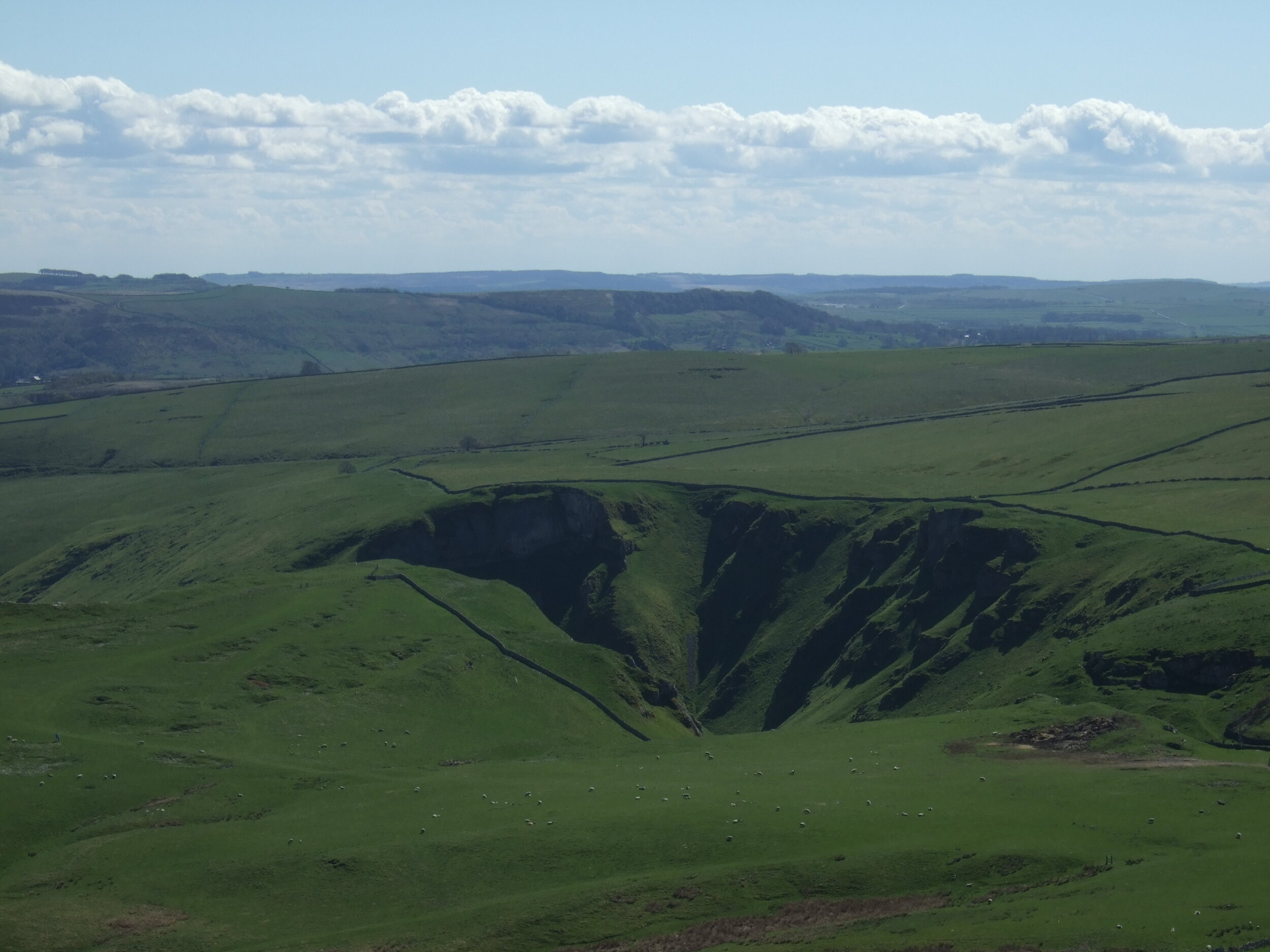
Well, apart from it being a 517m summit with cracking views all round, it’s known as the "Shivering Mountain". Whilst many might believe that this is due to the strong winds which are often encountered (hence the paragliders paradise), it is actually due to geology. The East face is crumbling shale rock. Underneath, the old A625 road from Stockport to Sheffield went this way but in 1974 it was swept away by a landslide and never rebuilt. Incidentally, you can walk on the old road - well worth doing some time to see the broken and buckled tarmac.
A large Iron Age Fort used to be on the top of Mam Tor and the summit trig point is built on the site of a bronze age tumulus.
From the summit, the ridge line to Hollins Cross can be easily seen. Despite its popularity, this is one of my favourite walks because of the pure beauty and breathtaking scenery.
Reaching Hollins Cross, there are various options (6 paths converge here). It's a perfect place to study the map and practice taking compass bearings!
Opting for the bridleway heading East underneath Mam Tor, back towards Barber Booth, it was important to keep our wits about us for the sound of mountain bikers careening past. It's a popular descent route.
Reaching Harden Clough, the final kilometer back to Barber Booth was a pleasant amble across farmland.
Verdict: A great walk on good paths/tracks which takes in a range of scenery from open moorland, ridge lines and cultivated farmland.
Distance: Approx 10km
Map: OS Explorer (OL1) Dark Peak Area
Getting there: Peak District car park at Barber Booth. Alternative parking in Edale which would mean a slight alteration to the route taken. Using public transport, Edale is on the Manchester to Sheffield train line, further details here
Facilities: Pub and cafe in Edale, with more in Hope and Castleton
Accommodation: Lots of options! Choice of campsites in Edale plus YHA Edale.
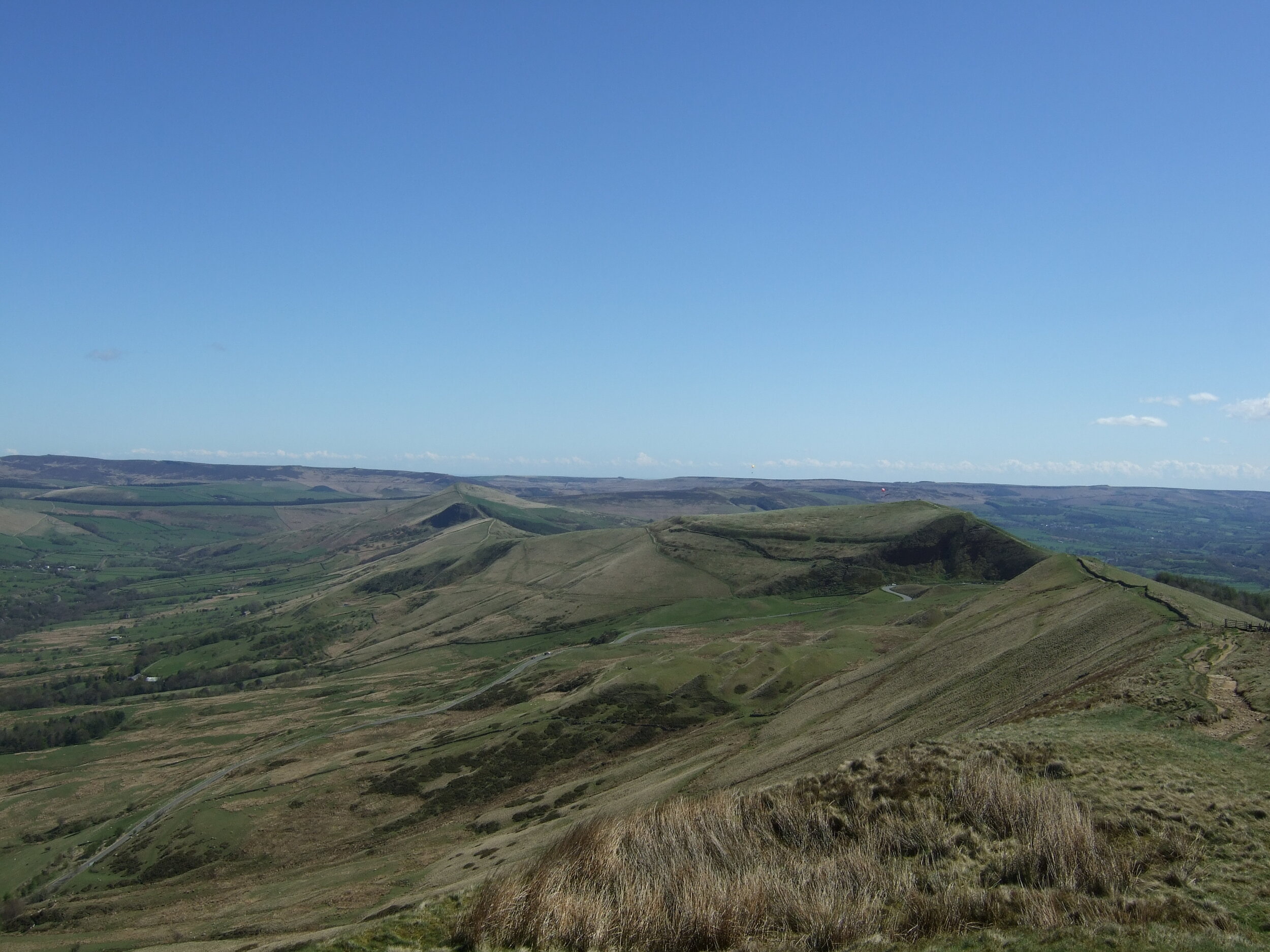
Rushup Edge to Mam Tor and beyond
Mam Tor summit - looking over Winnats Pass

Mam Tor summit
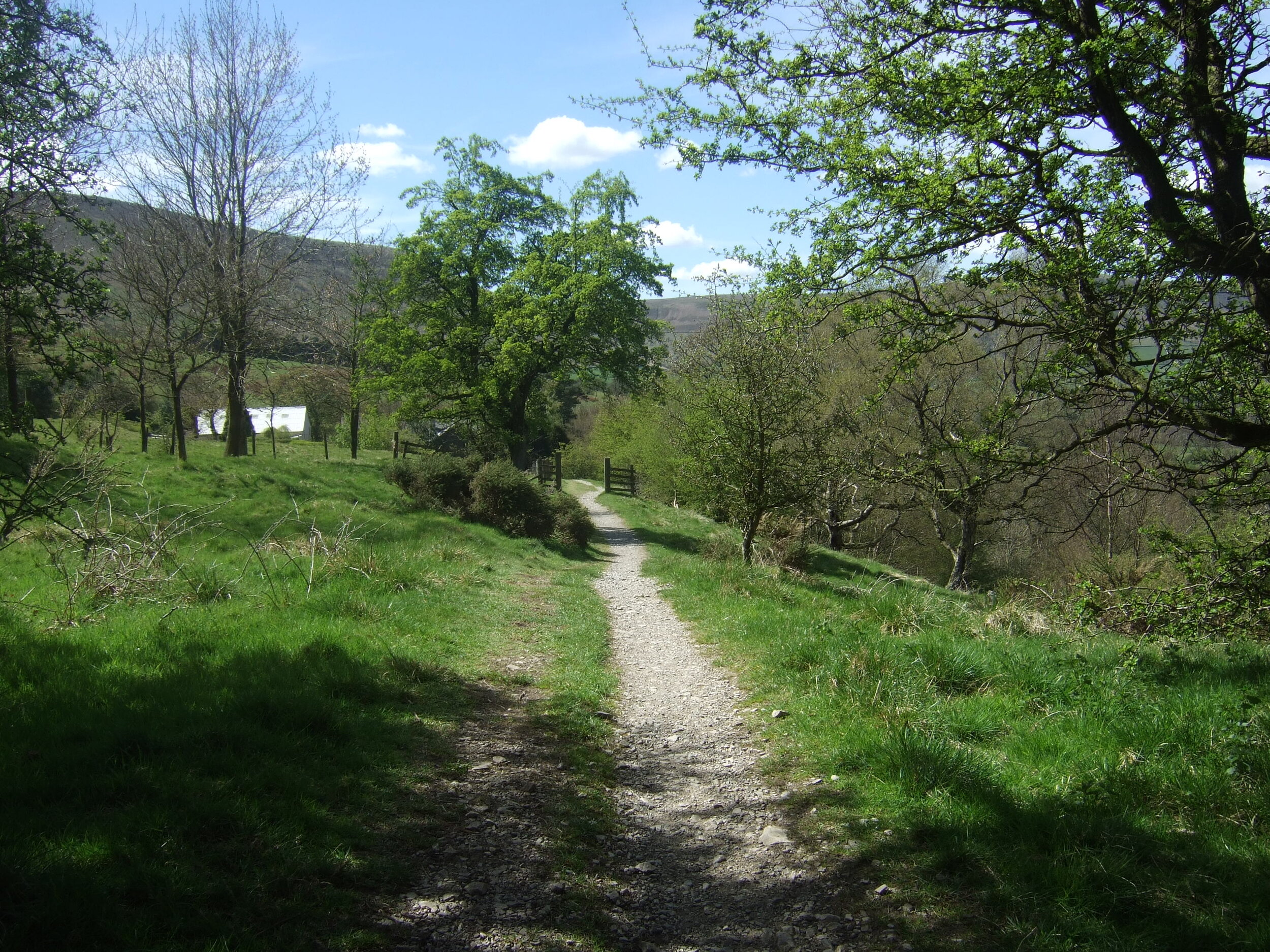
Ambling back to Barber Booth