Walk: Digley Reservoir to Black Hill Summit
Around 25 years ago, I decided to walk the first week of the Pennine Way with friends.
I grew up in Malham and family still lived there at the time. The plan was to backpack from Edale to Malham where we were guaranteed a good meal, hot shower and some home comforts as our reward.
We started training for the challenge, doing lots more walking at the weekends and carrying more in our backpacks in preparation for carrying our homes and 7 days worth of food and clothing. We also researched the route and the more I read, the more I worried about the first two days.
Black Hill's dark reputation
The first day of the Pennine Way is Edale to Crowdon (16 miles), climbing up onto Kinder Scout and then over the difficult sounding Featherbed Moss - full of peat bogs. The second left Crowdon to climb up the terrifying challenge that was Black Hill. The name filled me with doom, never mind the reputation that the hill had.
Apparently, in wet weather, the trig point was almost unattainable due to the thick gloopy peat bogs surrounding it and there were tales of people who had sunk to their untimely death in the bogs. Whether the stories were true or not was irrelevant, I was officially freaked out by Black Hill.
As it turned out, we set off on our challenge and the first day beat us into the ground. The terrain was more challenging than anything we'd done in training. Our legs were exhausted with the ups and downs of the peat bogs on Featherbed Moss (and I happened to fall into one up to my thigh, needing to be pulled out by the others - which made my freak out over Black Hill even greater).
By the time we arrived in Crowdon, we'd had enough. One of my friends had horrific blisters on her feet and that was the final straw, we beat a retreat to the nearest train station (still a fair walk away) and headed home.
Since then, Black Hill has remained this fearsome challenge - one which to be honest I could have quite happily lived without despite it being practically on my doorstep when I moved to West Yorkshire.
However, I think the years have been kind to Black Hill, there has been tons of regeneration work carried out (including a flagstone path) and from seeing pictures taken in the summer, vegetation has started growing there again. Check the Moors for the Future website to read more about the work which has been done here.
So when my husband suggested a winter walk from Digley (near Holmfirth) to the summit of Black Hill one snowy January day, I decided to put my fears to rest.
Digley Reservoir to Black Hill summit
The route to Black Hill
Parking in the free car park at Digley Dam (arrive early at the weekend), we started walking clockwise around the reservoir, keeping the water on our right.
After around half a mile (approx 10 minutes) you cross a footbridge and then turn left taking a path which has a river on the left. Climb steadily uphill until you come to a lane.
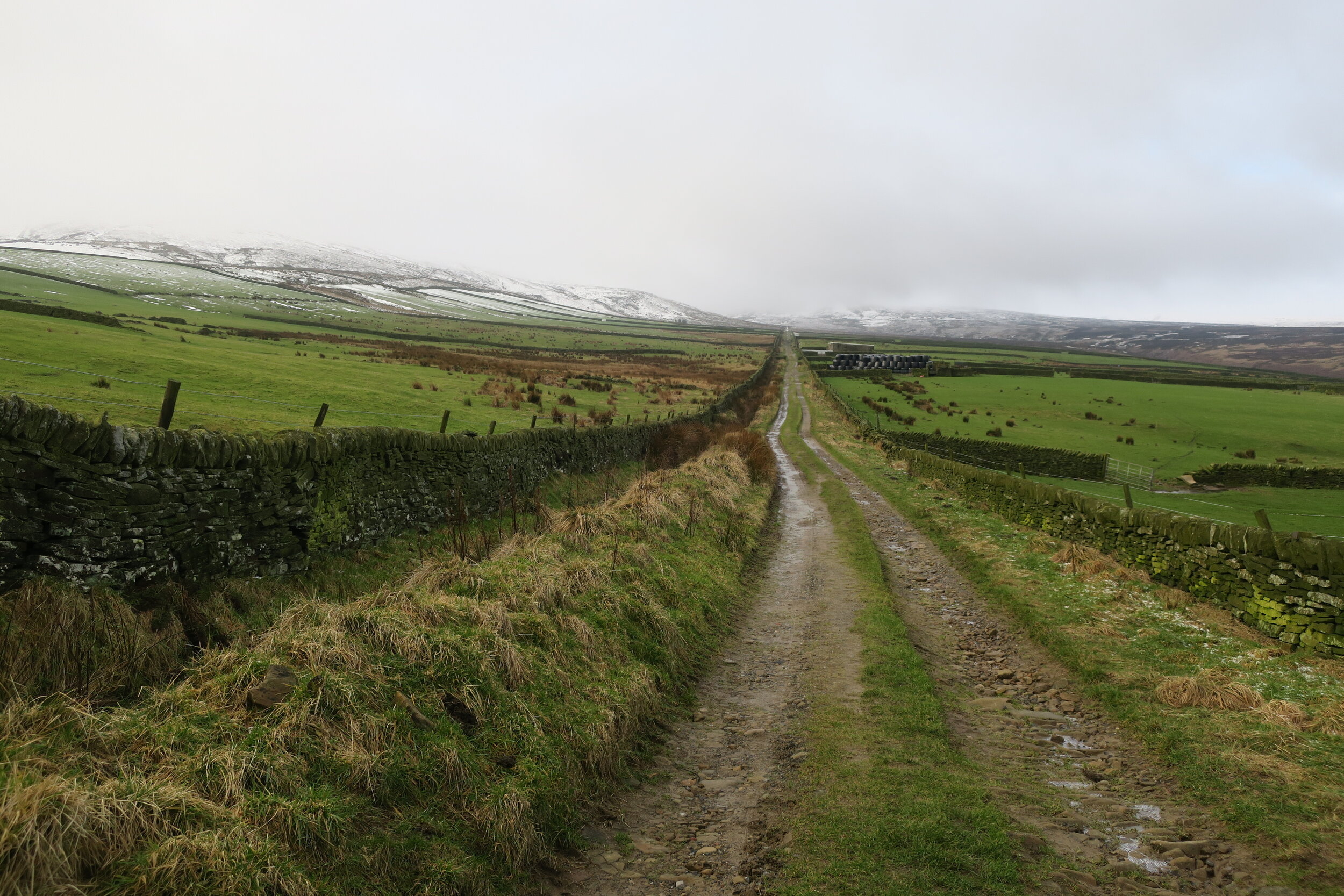
Turn left on the lane, following for approx half a mile it until coming to a t-junction lane. Turn right onto Issues Road (track). Issues Road is a long straight track (were the Roman's here?) which heads directly towards Issue Clough on the flanks of Black Hill.
It's easy walking (and route finding) at this point, climbing at a steady gradient. After around 0.75 miles, the track splits with the right hand path forming part of a short circular walk back to Digley reservoir.
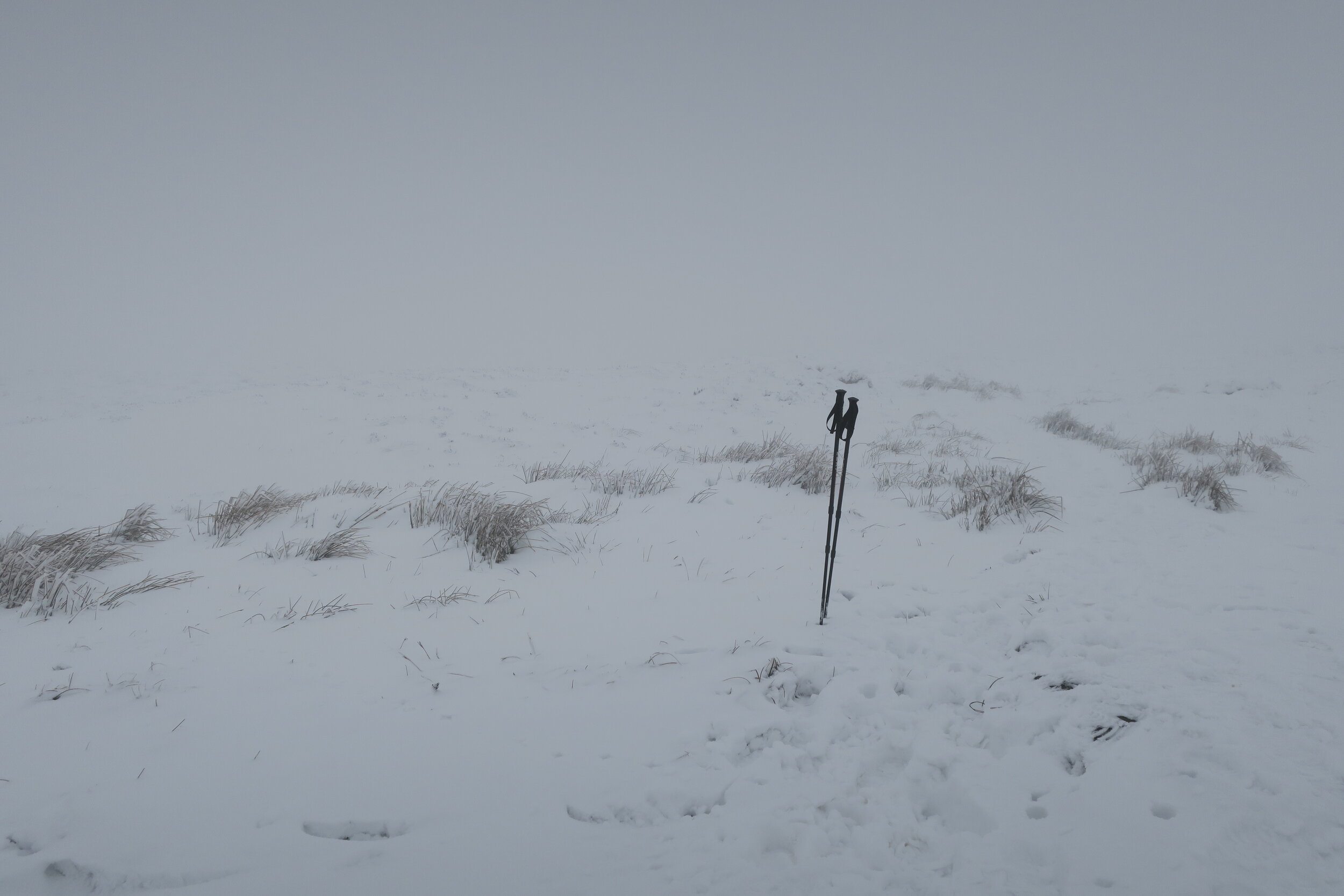
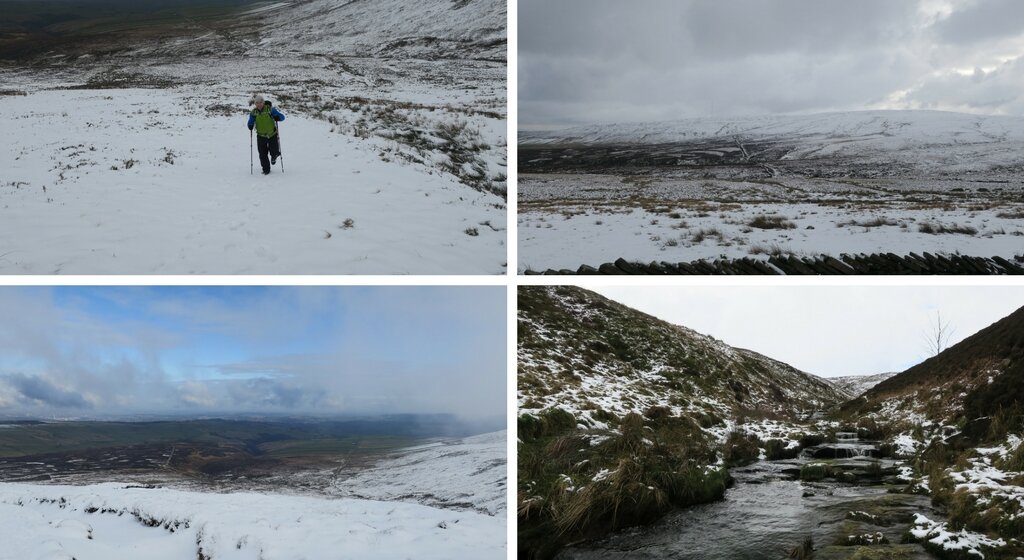
Taking the left hand path, towards Issue Clough, cross the stream and then climb uphill before contouring right to meet the main Pennine Way. This is where things became more interesting for us as there was a good layer of snow on the ground as we started gaining elevation. Thankfully, somebody had broken trail already and we had a set of footprints to follow (and thankfully, they were heading in the right direction).
The Pennine Way, 25 years on
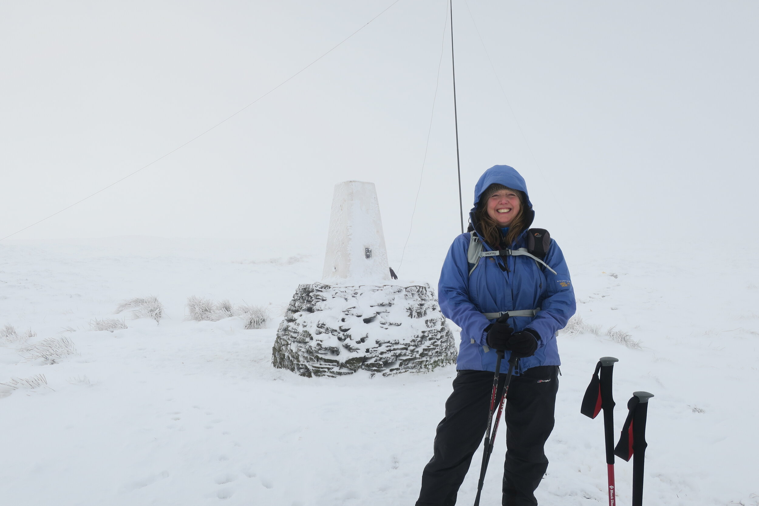
Black Hill, snowy summit
Arriving at the Pennine Way (you'll know as it's paved with flagstones), turn left and head towards Black Hill summit.
After 25 years, I finally circled the summit trig point. It was nothing like the horror stories from back in the early 1990's, although to be fair the snowy conditions covered everything. Having said that, those solitary footprints we followed all the way were on flagstones (our walking poles kept hitting the stone) so even in wetter conditions I think it would have been ok.
We missed a summit view (isn't that often the case) as the mist was down low and the wind was freezing cold. I have no idea how the guy we met there setting up his short wave radio mast for 'Summits on the Air' was going to survive an hour or so sitting next to the trig point!
After a quick round of summit photographs and a warm drink, we turned round to retrace our steps back down the Pennine Way.
Wet or dry weather?

View over Digley Reservoir
As we dropped down to the snow line, the mist cleared to give amazing views over towards Digley Reservoir and Huddersfield beyond. It would have been rude not to stop to admire the view over lunch - and take a last opportunity for snowball fights and sledging in our waterproof trousers.
At the point where we'd originally joined the Pennine Way, there's an important decision to make. If the conditions are particularly wet, this is the way back home as there is a ford crossing at Dean Clough which is impassable in flood.
It's a good half mile walk before you know for sure - however, we were pretty certain it would be fine and forged ahead on the Pennine way towards the A635 Huddersfield to Greenfield main road.
Snoopy's if you're lucky
Turn right on the road before taking the first path on your right back towards Digley a few metres away. If Lady Luck is on your side, Snoopy's snack wagon will be there to refresh you with hot tea and bacon butties!
Following the path back to Digley, you're now on the Kirklees Way pretty much all the way home.
Walk downhill through fields before contouring the hillside, then crossing a stream before coming to a stile - approximately 3/4 after leaving the road.
Follow the lane for a mile, then turn left downhill towards the dam between Bilberry and Digley reservoirs.
Cross over the dam and follow the path alongside Digley reservoir (keeping the water on your left) back to the car park and your starting point.
Distance: 7.5 miles
Time: Approximately 5 hours
Total Ascent: 1,562 feet
Parking: Digley Reservoir Dam Car Park, Grid Reference SE 109 067 (Postcode: HD9 2QD)
Map: Ordnance Survey - OL1 Dark Peak
Nearest Pub: The Fleece Inn, Holme
Route: www.plotaroute.com/route/564169(once you've opened the route, click on "Paths Map")

Digley to Black Hill route
Digley to Black Hill