Walk: Usha Gap to Keld, via Muker
Many years ago, I remember going home to visit my parents in the Yorkshire Dales and heading into the Northern Dales for the day, driving over the Buttertubs Pass (one of the big climbs on the Tour de France Grand Depart in 2014).
We stopped at Keld and walked down Swaledale to Muker, catching a bus back to our starting point. It stuck in my memory for a couple of reasons - one, the views were simply breathtaking and two, whilst I was a big outdoor enthusiast by then, my parents weren’t, so it was a rare treat to share something I enjoyed so much with them.
When my husband and I visited the Muker area again recently, we decided to recreate the walk by wandering up the valley from Muker to Keld and returning along the Swale Trail high above the valley. It’s a pleasant walk, with a little uphill towards Keld but nothing to too strenuous if you’re a regular walker.
It’s worth noting that our route started from the campsite at Usha Gap, wandering along fields to arrive at Muker, so the downloadable GPS in the links below starts from there. If you don’t want to start from Usha Gap campsite, you can just start the route part way through at Muker.
Heading through Usha Gap campsite, walk through the farmyard into the first camping field and turn left following the footpath sign to Muker. The path runs alongside the larger camping field (it will be on your right over a wall) and is well signed through several fields to reach Muker.

Once in the village, turn left walking past houses and pick up the footpath sign to Keld, through Muker Meadows.
Keep to the flagstone path, walking gently downhill - some of the meadows in this area are protected as part of the Muker meadows Site of Special Scientific Interest (SSSI) and the Northern Pennine Dales Meadows Special Area of Conservation (SAC) due to their wide range of wildflowers and grasses.
Passing through several meadows, you’ll come to a stile crossing over to the River Swale. Turn left alongside the river and follow the path, keeping the river on your right.
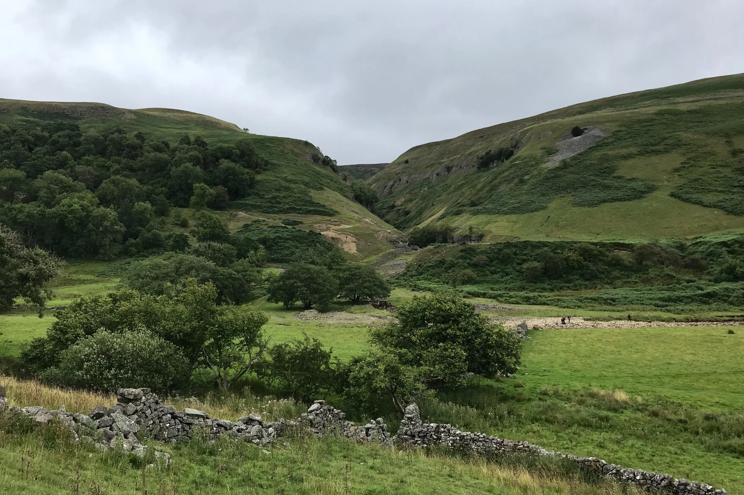
The route goes alongside the river before slowly climbing uphills through Rukin Wood.
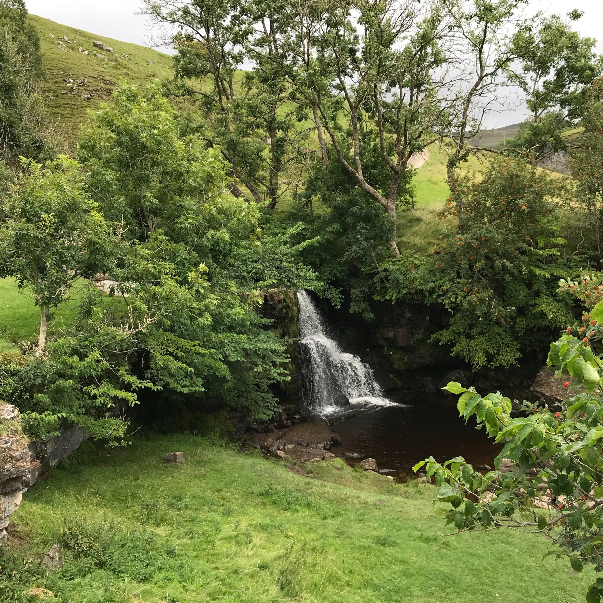
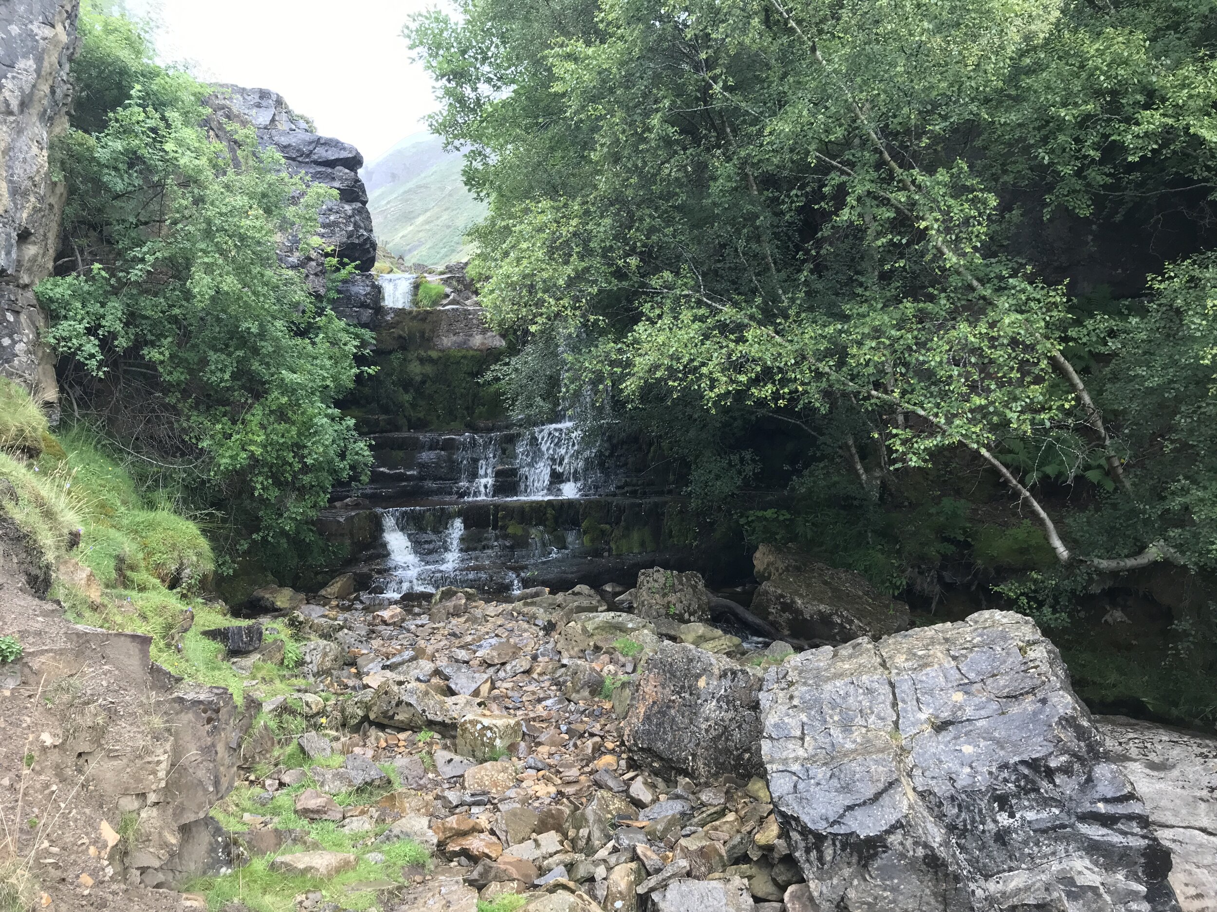
As you begin to drop downhill, you’ll see a footpath on your right signed ‘Kisdon Force’. This is an optional detour to see the waterfall which is a popular wild swimming spot (take extra care if you take the detour as the path becomes quite steep and slippy, even in dry weather) and returns to our route via the same path.
Continuing on the main path, you’ll soon come to the outskirts of Keld. The village is tiny but, if you’re lucky, by continuing straight ahead towards the campsite, the last house on your right may be selling tea, coffee, tray bakes and sausage rolls from the front door of their house. The garden is large and a pleasant place to sit and relax before the return journey. Toilet facilities are also available in the campsite car park just beyond!
Retracing your steps for around 300 metres, back through the village and onto the path, you’ll come to a left hand fork signed the ‘Swale Trail’. Take this path, dropping steeply downhill to cross the river and then back uphill on the other side continuing right when you meet another path.
Follow the track along the Swale Trail back down Swaledale towards Muker, with the river on your right far below in the valley.
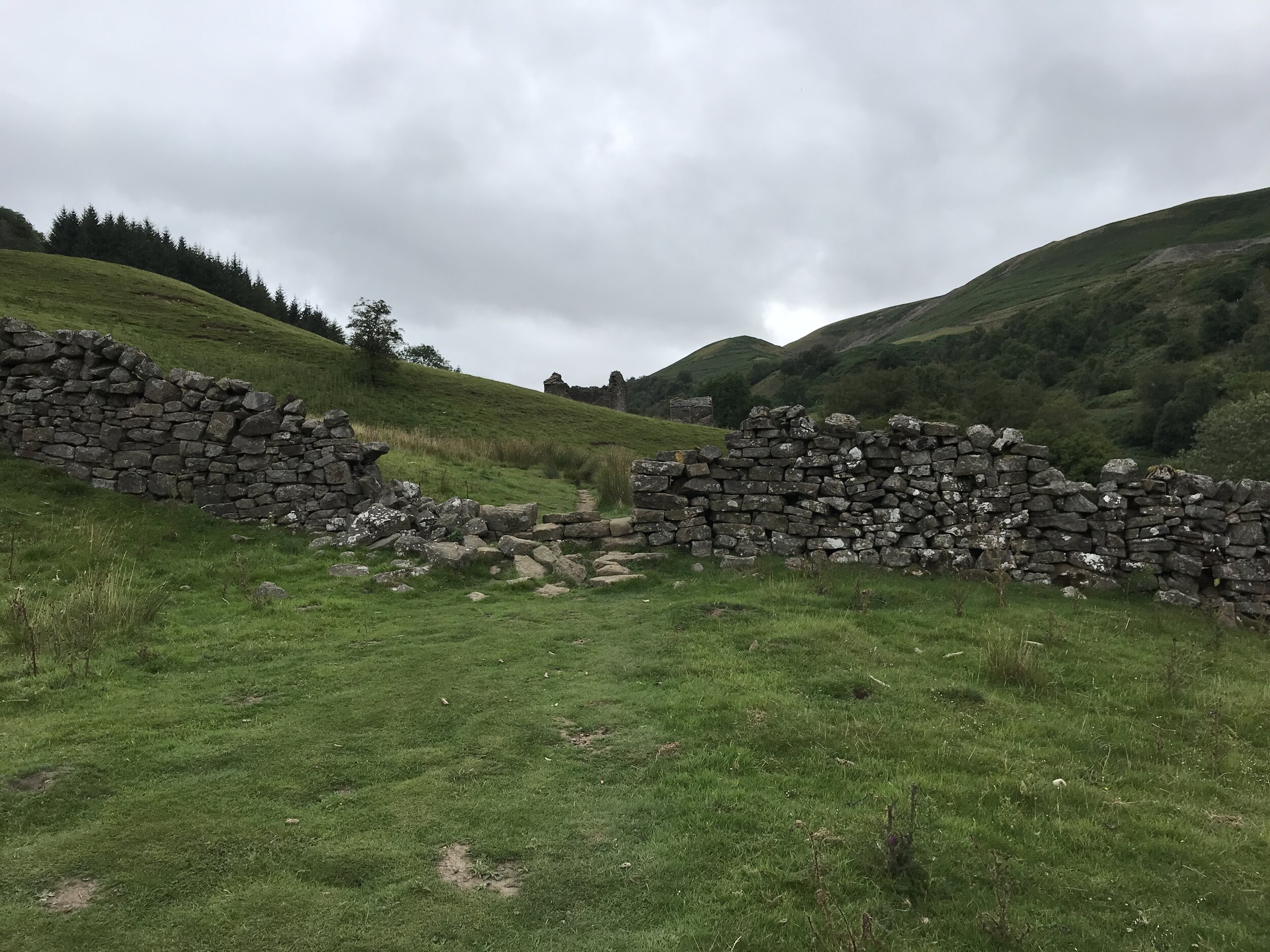
Approximately 3/4 mile later, you’ll see a track to your left which is another optional detour. Crackpot Hall is an 18th century farmhouse, abandoned in 1953 because of subsidence caused by nearby lead mining. It’s an intriguing place with the old fireside range still in place and an abandoned tractor nearby (an essential photo opportunity!).

Crackpot Hall, Swaledale - image by Ride Holme

‘Tractoring’ in Swaledale
Returning back to the main route via the same track, continue on, dropping downhill towards the bottom of the valley.
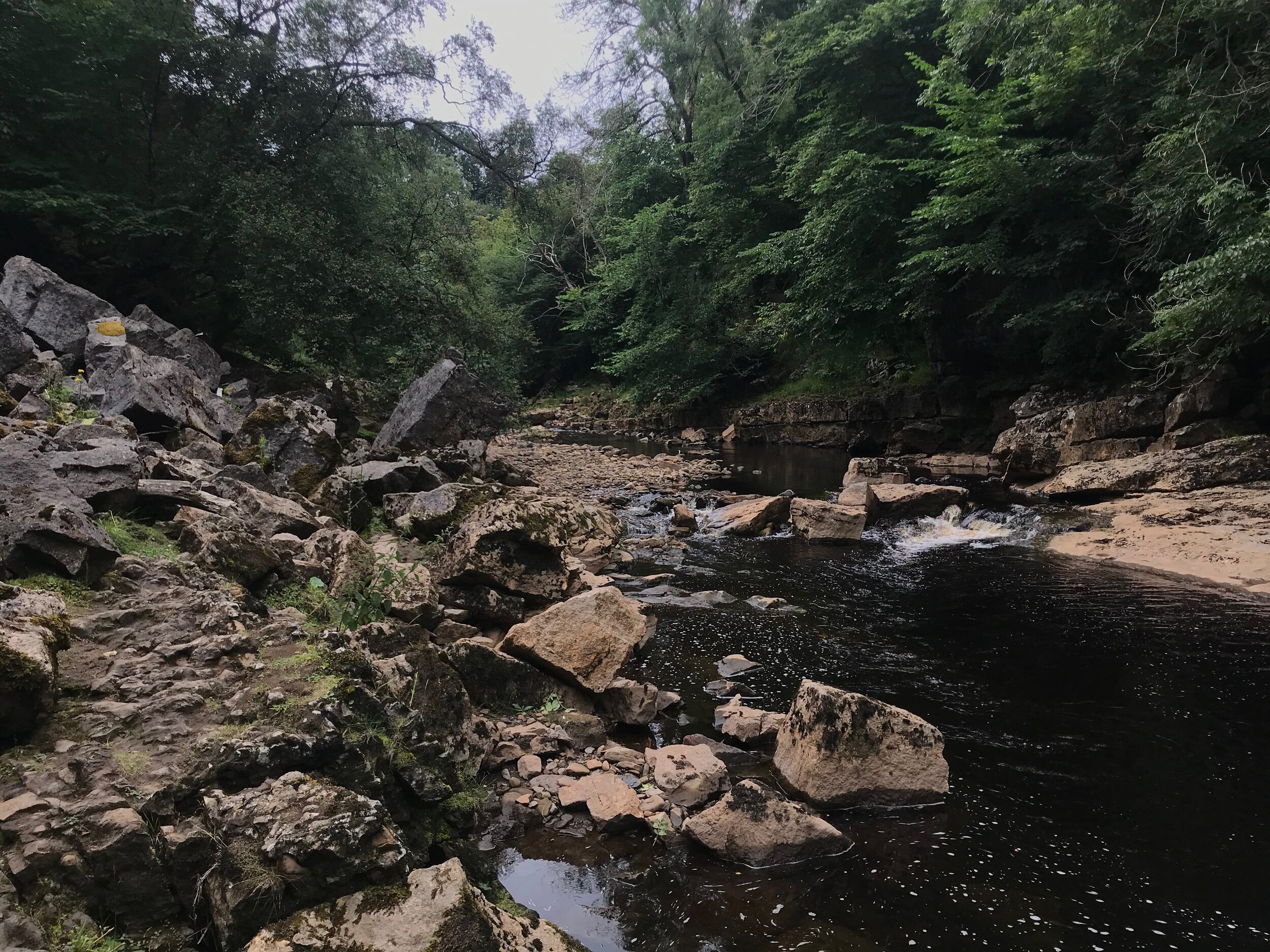
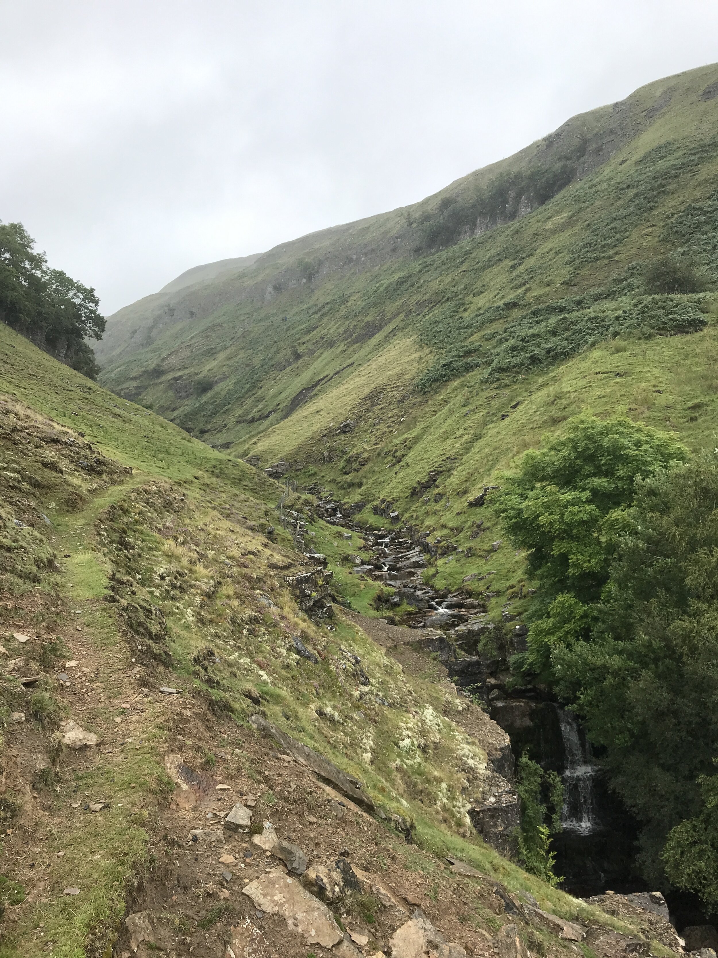
Cross the stream at Swinner Gill, near an old disused mine.

Swinner Gill
Just over a mile later, turn right off the Swale Dale to drop downhill to a bridge crossing the River Swale. Turn right alongside the river, then left over a stile to rejoin the path to Muker through Muker Meadows.
Retrace your steps back to Usha Gap campsite.
Useful information:
Distance: 7.63 miles
Time: 4.5 hours
Parking: Car parking in Muker
Public Transport: Check www.dalesbus.org for up to date information
Refreshments: Possible hot drinks and snacks at Keld, but not guaranteed (read route description above for details). Farmers Arms pub in Muker.
Where to stay: Usha Gap campsite near Muker, also check the Yorkshire Dales National Park accommodation search here.
Route: Click here for my free GPX download
Map: OS Explorer OL30 - Yorkshire Dales, Northern & Central Area

Enjoyed this article?

Outdoor-Girl is run by Jacquie Budd, a published walking guidebook author and freelance content writer helping businesses and charities connect with their customers via content strategy and search engine friendly blog posts.
Visit www.jacquiebudd.com for more information.