Walking the Kentmere Horseshoe, Lake District: Route and Wainwright summits
-
If you click a link with an * and buy from a company’s website, I may receive a small payment. This helps fund the Outdoor Girl site and keeps it free to use with no annoying pop up adverts.
But there are a couple of crucial things you need to know about this:
It never impacts my content or recommendations – if I include something, I genuinely think will be helpful
There is no extra cost to you when buying via one of these links
For a more detailed explanation, see my policy on affiliate links, including Amazon Associate links.
For transparency, you can also find duplicate links below that don’t help fund the Outdoor Girl website.
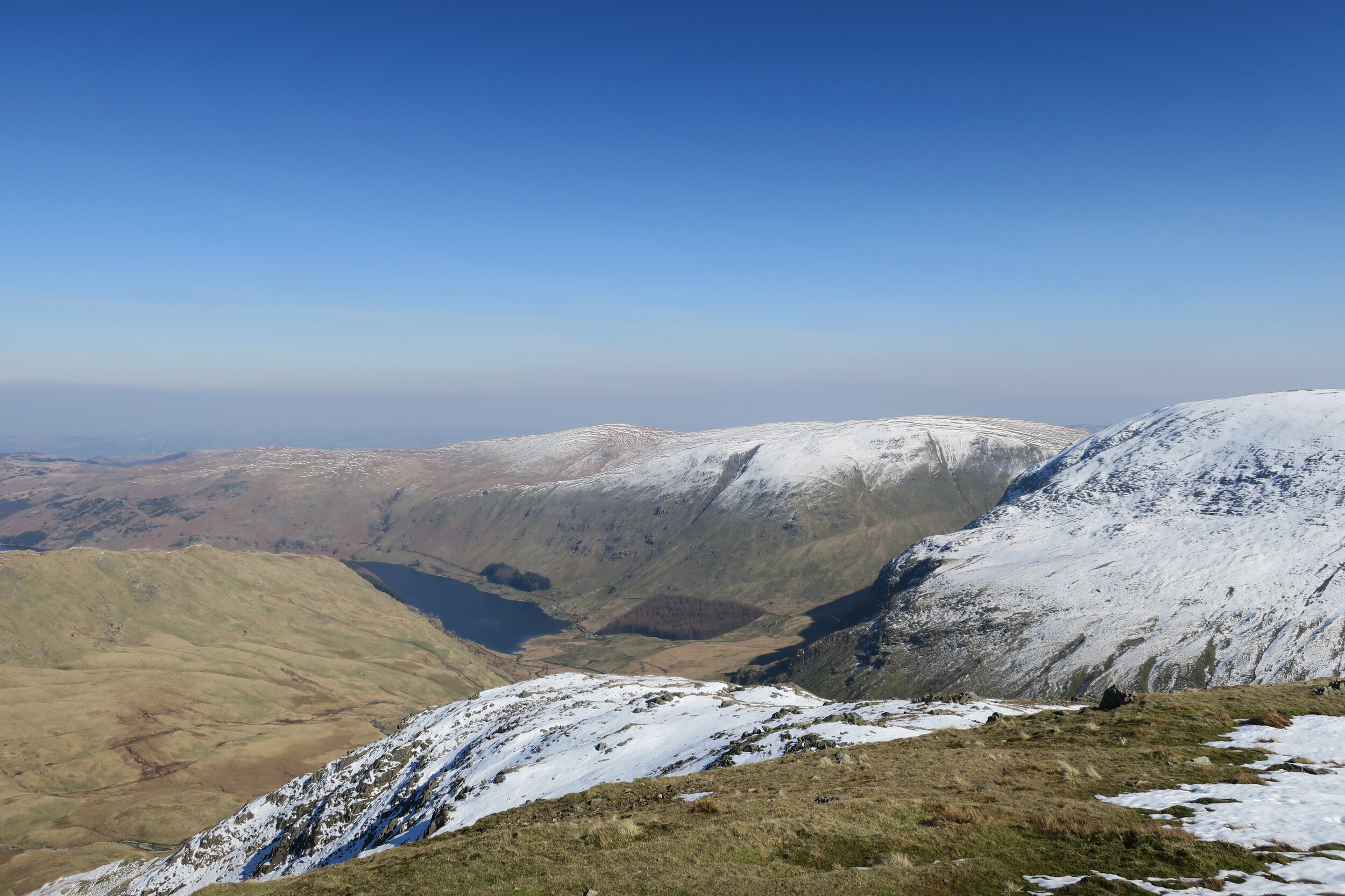
View over Haweswater from the Kentmere Horseshoe
The Kentmere Horseshoe is a classic Lake District circular ridge walk taking in 8 Wainwright summits with the option to extend the route to High Street for a 9th. It’s a big mountain day out and widely considered a challenging route.
The distance is 13 miles, with most guides suggesting 6-8 hours to complete.
Conditions make a huge difference on this walk. On a clear day, it’s spectacular with far reaching views, but it’s still a serious day in the hills.
This guide was last updated in June 2026.
Kentmere Horseshoe walk at a glance
Distance: 13 miles (21.6 km)
Time: 6-8 hours
Difficulty: Hard / long mountain day
Ascent: Approx 1,100 - 1,200 m
Summits (main route): 8 Wainwrights (Yoke, Ill Bell, Froswick, Thornthwaite Crag, Mardale Ill Bell, Harter Fell, Kentmere Pike, Shipman Knotts)
Optional extension: High Street (9th Wainwright)
Start point: Kentmere village (extremely limited parking)
Navigation: OS 1:25,000 (OL7 The English Lakes, South Eastern Area) - map, compass, and GPX strongly recommended
Route map / GPX: Trail Magazine Kentmere Horseshoe (OS Maps)
Facilities: Nearest in Staveley
Best direction: Either direction - clockwise via Garburn Pass is most commonly walked (as described below)
Important note:
Kentmere village is approximately 4 miles north of Staveley. Parking is extremely limited (around 6 cars maximum), and the access road is a narrow single-track lane with passing places, so roadside parking is not really an option. There are no pubs, shops, or cafes in the valley, so you’ll need to arrive fully prepared.
Garburn Pass ascent
Route overview
The route is a full circular ridge around the Kentmere valley, linking 8 Wainwright summits including Yoke, Ill Bell, Froswick, Thornthwaite Crag, Mardale Ill Bell, Harter Fell, Kentmere Pike, and Shipman Knotts. A short extension to High Street adds a 9th summit before the return via Nan Bield Pass.
Kentmere Horseshoe route description
We’d booked a week away in Kentmere. This sleepy hamlet, tucked into in the south-eastern Lake District, was somewhere I’d dismissed for years. Being right on the edge of the Lakes, I’d assumed there would be no real mountains of note - maybe even something a bit featureless.
How wrong I was.
It’s a stunning part of the Lake District, made even more so by its remote feel. There are around 60 houses in the valley, spread along the River Kent, and the surrounding mountains are genuinely breathtaking.
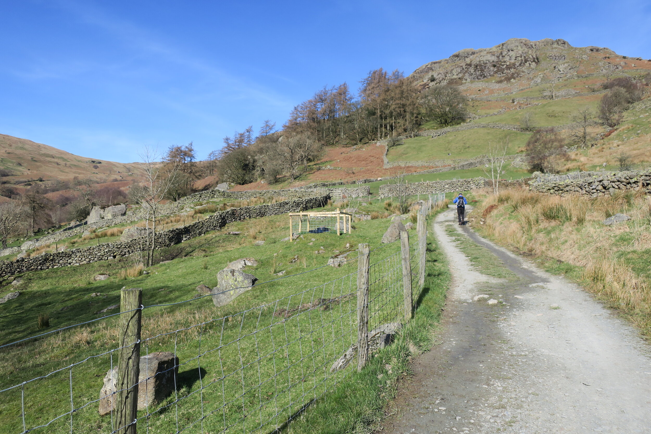
We started walking the Kentmere Horseshoe from the front door of our holiday cottage. Heading in a clockwise direction, we began climbing up the Garburn Pass. This wide track rose steadily, gently warming up our legs.
At the top of the pass, a right turn took us to Yoke (706m) and our first Wainwright summit of the day. From here, we stayed high for most of the walk, before dropping off Kentmere Pike on the return.
But staying high didn’t mean the climbing was over!
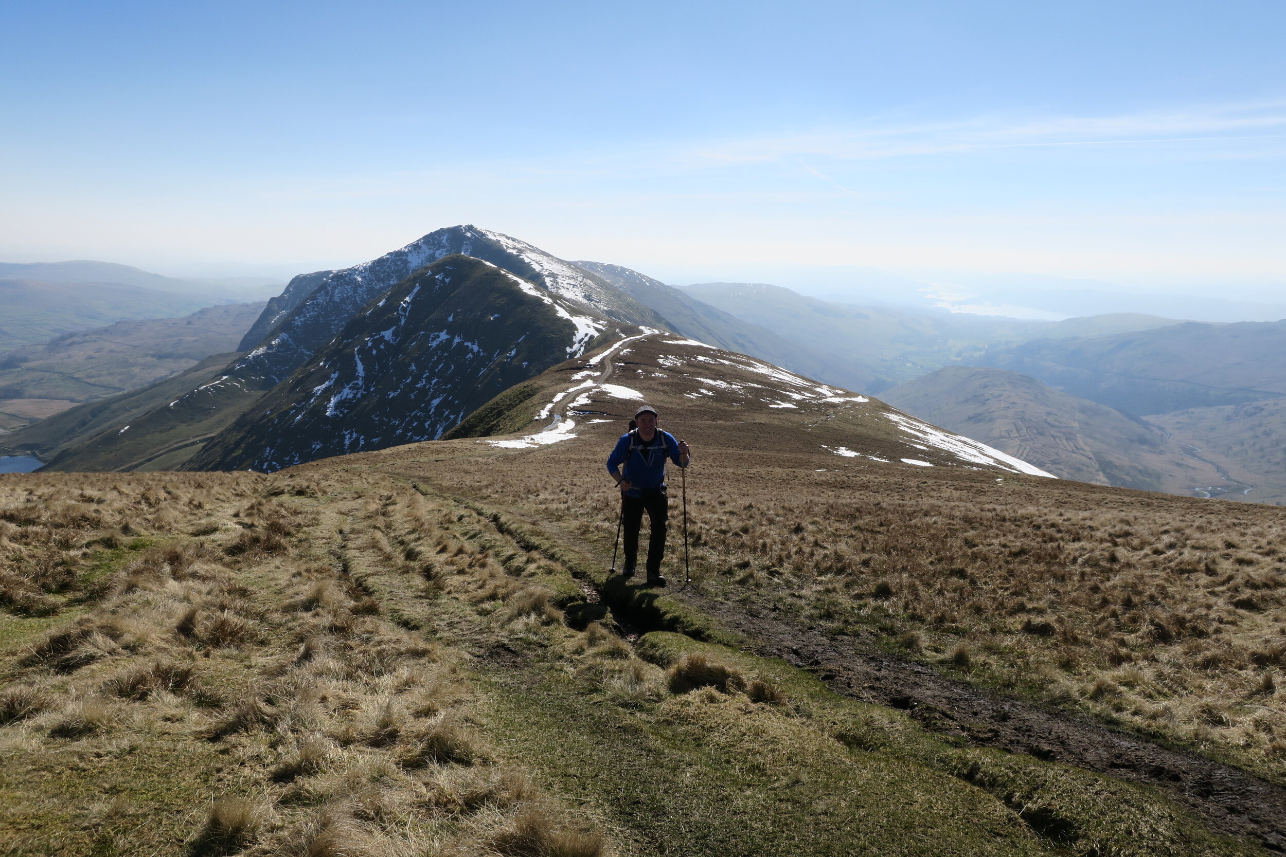
Looking back towards Froswick and Ill Bell
Ridge walking: Ill Bell to Thornthwaite Crag
Continuing on along the wide ridge to Ill Bell (757m), Froswick (720m), and Thornthwaite Crag (784m) involved some pretty steep ups and downs. But the effort paled into insignificance with the amazing views to both sides. This section of the walk is where the Kentmere Horseshoe really opens up with continuous ridge walking and wide views across both sides of the Lake District.
If you’re thinking about walking the Kentmere Horseshoe, pick a clear day. I promise you, it’ll be well worth the wait.
After the beacon at Thornthwaite Crag the walk continued on towards High Street before turning right across the plateau towards Mardale Ill Bell (760m).
If you’re bagging Wainwrights and High Street (828m) is still on your list, a short detour will take you to the summit. As we’d already ticked High Street a few years before, we turned right to enjoy snowy walking across the plateau.

View from Nan Bield Pass
Mardale Ill Bell with incredible views across Haweswater
To tick the summit of Mardale Ill Bell, we had to make a short detour from the path. It was worth the effort. Sitting at the cairn, resting our legs, we looked out across Haweswater.
The view was incredible and a good enough reason for the detour, even if you’re not interested in ticking summits.
A little wander from the cairn opened the views up even more, looking over Blea Tarn with the steep sided cliffs above. It’s honestly one of the most picturesque vistas I’ve seen in the Lake District and somewhere I want to visit again.
Nan Bield Pass and the return leg
As we continued on towards the Nan Bield Pass, our legs were beginning to protest the miles.
Walking the rocky 130m down to the pass was disheartening, knowing there was a similar climb back up the other side. The summit cairn of Harter Fell (778m) was a welcome sight.
We stopped for a brew and emergency butty, ready to tackle the return leg of the horseshoe.
Dropping off Harter Fell, a short climb up to Kentmere Pike (730m) gave us our last summit of the day. From here, we took a path diagonally back downhill towards the Kentmere valley and Hallow Bank/Brockstones where a gentle meander along the bridleway brought us back into Kentmere village.
For the full Kentmere Horseshoe (and to tick the 8 Wainwright summits) we should have carried onto Shipman Knotts (587m) before dropping into to Kentmere. But the walk had taken it out of us and we were ready to get back to the cottage.
Looking back now, I wish we’d carried on and finished the full route. Hindsight is a wonderful thing - but it’s a good excuse to go back and do it all again.
One of my favourite mountain days
Although I had a problem with a cramping leg muscle after the Nan Bield Pass, the walk will still go down as one of my all time favourite days in the mountains.
The weather was perfect with sunny, still conditions and unbelievable views across the Lake District. I know how lucky we were - it’s rare to bask in sunshine without a breath of wind at summit cairns, especially in March.
Those memories and views will last a lifetime.
I also loved exploring a completely different area of the Lake District. I saw so many well-known mountains from a new angle. And the views, they’re worth another mention!
Key tips for walking the Kentmere Horseshoe
Map: OS 1:25,000 (OL7 The English Lakes, South Eastern Area)
Route map / GPX: Trail Magazine Kentmere Horseshoe (OS Maps)
Best weather: Clear day recommended (for incredible views)
Direction: Clockwise or anticlockwise can be done - most popular is clockwise and it’s the direction we took
Water / refreshments: Go prepared - none in Kentmere or on the walk (nearest in Staveley)
Shops, cafe, and pubs: Can be found in Staveley - Wilf's Cafe is iconic
Parking: Extremely limited in Kentmere
Public Transport: No direct public transport to Kentmere. Bus or train to Staveley then either taxi or walk to Kentmere.
Accommodation: Lake District National Park website
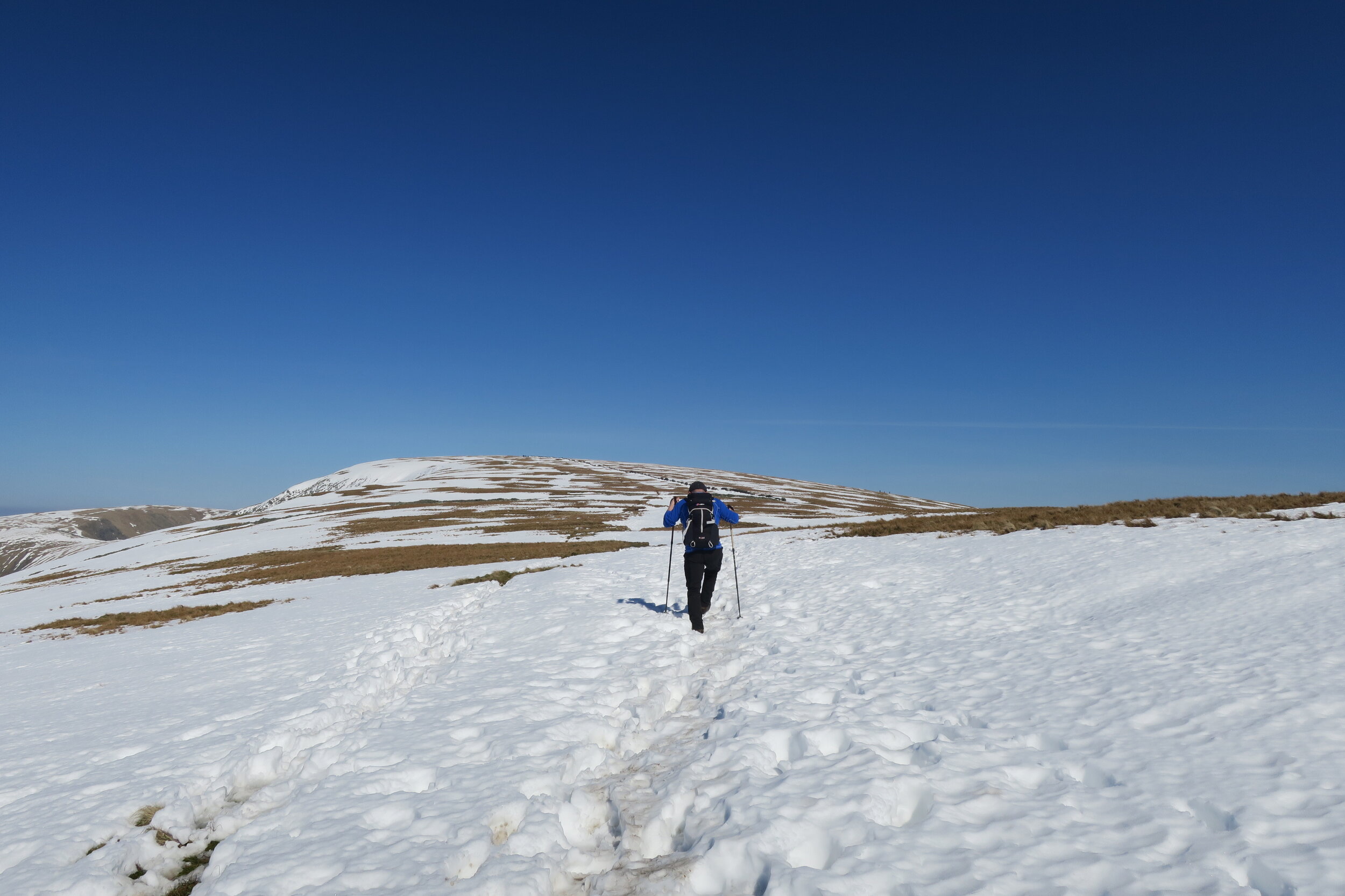
Snowy plateau on the Kentmere Horseshoe

Walking off Kentmere Pike
FAQs about walking the Kentmere Horseshoe
-
Yes. While is not technically difficult walking, it’s a long and demanding mountain route with some steep ascents. It’s best suited for experienced walkers in good conditions.
-
Most walking guides suggest allowing around 6-8 hours depending on pace, conditions, and stops.
-
Not ideally. It’s a big mountain day with navigation required, especially in poor visibility.
-
The Kentmere Horseshoe can be walked either clockwise or anticlockwise. The most popular option is clockwise via Garburn Pass as it gives a gradual start and you get a breathtaking panoramic ridge walk.
-
Parking in Kentmere (near St Cuthbert’s Church or the Institute) is extremely limited. The roads into the village are too narrow for roadside parking. Either arrive very early or book a taxi from nearby villages.
You might also like:
For multi-day circular walks in the UK:
https://www.outdoor-girl.com/blog/best-circular-multi-day-walks-uk
For multi-day walks in the UK:
https://www.outdoor-girl.com/blog/best-multi-day-walks-uk
For walks in Alston and the Cumbrian North Pennines:
https://www.outdoor-girl.com/blog/walking-in-alston-and-the-cumbrian-north-pennines
If you enjoyed this post, or found something helpful, you can say thanks with a one-off cuppa (or maybe an adventure snack) here →
It’s never expected, but a big thank you if you can 🫶
LOVE THE OUTDOORS?
Get inspiration for big trips and small adventures, straight to your inbox.
Outdoor-Girl is run by Jacquie Budd, a UK-based outdoor adventure writer and SEO content specialist. She’s a member of the Outdoor Writers and Photographers Guild, combining outdoor storytelling with SEO content and web design for small businesses.
What do the links with an * mean?
Links with an * by them are affiliated which means if you get a product via this link, a contribution may be made to the Outdoor Girl website, helping it stay free to use.
You shouldn’t notice any difference in the product or cost. Importantly, the content I write is NEVER impacted by these links. For more details, please read my policy on affiliate links, including Amazon Affiliate links.
As I believe transparency is important, I’m sharing the un-affiliated links too, but note this version does not help the Outdoor Girl website.
Unaffiliated web addresses for the * links in this blog post:
None