Walk: Wessenden and West Nab
This circular walk over superb moorland starts up high from a parking area on Wessenden Head Road.
The route drops gently across moorland with stunning views all the way to Deer Hill reservoir on the outskirts of Meltham. From here, a bridleway leads uphill to Wessenden Head Road, the first real climb on the walk.
With an absence of footpaths in this area, it's necessary to return to the parking area along the grass verges of Wessenden Head Road - take care as this can be a fast road.
Crossing the road from the parking area, the route initially follows a wide track (signed the Pennine Way) past Wessenden Head reservoir.
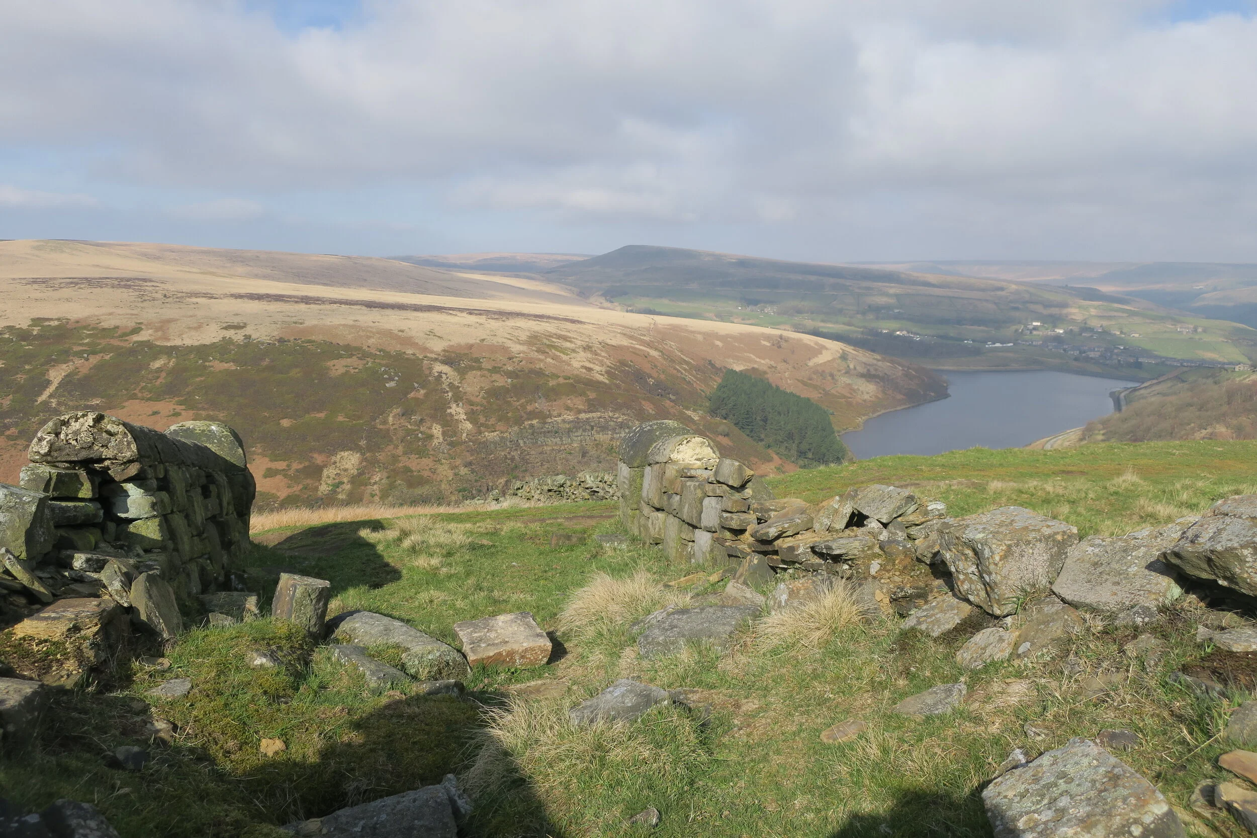
Just after passing Leyzing Clough, fork right on a narrow path which climbs gently before traversing the hillside above Wessenden, Blakeley and Butterley Reservoirs.

Shooters Nab
At the end of the reservoirs, the path naturally curves right on a defined track (the Deer Hill Conduit), giving superb views over Marsden.
Continuing on the conduit, you'll see a rifle range on your right hand side. Yep, you read that correctly, a rifle range, complete with marked targets 1 to 10. I'd seen the Danger area marked on the OS map, but was amazed to see the targets from the path. It gave me an "aha" moment when I realised that the crag above is called 'Shooters Nab'.

Deer Hill reservoir
Pressing on, the conduit leads to Deer Hill reservoir, situated high with views over Slaithwaite and Meltham. Follow the tarmac road which goes around the reservoir, continuing on downhill to a distinctive left hand bend after you leave the water.
Soon after, take a bridleway on your right. This is a wide track which curves to the right at a wall and then continues downhill. Go through the gate and turn right, then left at the next junction to pass a derelict building and cross over a small waterfall.
Beyond the waterfall, follow the path to a gate. Turn right here, going through a gate to follow a bridleway. The track climbs uphill, passing by a woodland on your left to meet Wessenden Head Road.
Turn right on the road and walk uphill for approximately 1.5 miles (see optional detour below) back to the parking area. Take care on this road as you will need to walk on the grass verges.

West Nab
Optional detour:

From Wessenden Head Road, you can take a path leading to the summit of West Nab (500m) before dropping back downhill to rejoin the road a little further on.
At a lay-by on your right, just past a large boulder painted 'Cock Crowing Stone', cross the stile onto SSSI protected land (note that the landowner has excluded dogs from this land).
The stone is such an oddity that I attempted a little research. However, little is known about it's history. The name 'cock crowing stone' is often given to standing stones with folklore attached, perhaps a cock or grouse perched on top of the stone to crow each morning, or maybe it simply marks the entrance to an old quarry.
I'll leave you to make up your own story and return to our route…..
Following the path from the lay-by, the way climbs steadily uphill to reach the summit of West Nab, which has spectacular views on a clear day. It was also refreshingly peaceful when I visited, so I took the chance to lean back and soak up the early spring sunshine with a well earned hot chocolate. Apparently, the summit is rumoured to be a site of ancient worship and Druid rituals - if worship and rituals need incredible views, I can well understand why!
Once rested (or worship completed), you can return either via the same path and pick up the road again, or follow an alternative path from the summit which heads straight downhill bringing you onto the road a little further along. However, please note that at the time of writing, the stile over the fence from this path was a little dilapidated requiring good balance to cross on single wooden posts either side of the fence. It will be even more of a challenge in wet weather as the ground around here was pretty boggy.
Once back at the parking area, you might be lucky and find the iconic Snoopy’s snack van (occasional van) at the junction of the A635.
Useful Information:
Important note: West Nab is on SSSI land and dogs are not permitted. There are roadside signs on the paths leading up to the summit.
Distance: 8.5 miles
Time: 3 - 4 hours
Parking: Free of charge (Grid Reference SE 077 075)
Refreshments: Occasional snack van on the A635 Holmfirth to Greenfield road at the junction with Wessenden Head Road. Otherwise, Meltham or Holmfirth for shops, pubs, and cafes.
Toilets: None on route
Route: Grab my free GPX download of the route on Outdooractive
Map: OS Explorer OL1 Dark Peak Area and OL21 South Pennines (sadly 2 maps are required as the route is split by the borders of each map!)


Map showing the area walked - click the image to open in Outdoor Active
You may also be interested in reading:
Walk: Wessenden and Black Hill on the old and new Pennine Way routes (9.5 mile challenging walk across open moorland, requiring careful navigation skills)
Circular walk from Holme: wet and wild! (5 mile walk from Holme village)
What are the Peak District Ethels?
ENJOYED THIS POST? HERE’S HOW YOU CAN SUPPORT MORE CONTENT…
I’m an outdoor enthusiast, just like you, looking to read about fun and inspiring adventures. I write from my personal experience and ideally want to keep this website ad-free (who likes annoying pop-up ads getting in the way). But web hosting and creating new content costs money, and means a fair bit of unpaid work.
If you’ve been inspired, grabbed a GPX download, or found something helpful, you can support by buying me a cuppa via my Ko-Fi account. Thank you if you can 🫶
Get new adventures sent directly to your inbox. Emails usually go out every other week.
SIGN UP TO MY NEWSLETTER
Outdoor-Girl is run by Jacquie Budd, an outdoor adventure writer and marketing content writer for brands that care about their impact on people and the planet.